METAR-TAF
Aeroporti :
Sagona Island
Amqui
Argentia
Baie-Comeau
Bar Harbor
Bathurst
Beaver Island
Blanc-Sablon
Brier Island
Cap-Chat
Cap D Espoir
Cape Race
Cap Madeleine
Caribou
Caribou
Cartwright
Charlo
Charlottetown
Chéticamp
Churchill Falls
Debert
Deer Lake
East Point
Englee
Ferolle Point
Fredericton
Frenchville
Gagetown
Gander
Gaspé
Goose Bay
Grand Étang
Greenwood
Halifax
Hart Island
Havre-Saint-Pierre
Heath Point
Hopedale
Houlton
Ile Aux Perroquets
Isole della Maddalena
Kejimkujik National Park
Kentville
Longue-Pointe-de-Mingan
Magdalen Islands
Makkovik
Malay Falls
Mary's Harbour
McNabs Island
Moncton
Mont-Joli
Natashquan
New Carlisle
North Cape
Pointe-des-Monts
Pointe-Noire
Point Lepreau
Port Hawkesbury
Port-Menier
Presque Isle
Rocky Harbour
Sable Island
Sagona Island
Saint John
Saint John's
Saint-Léonard
Saint-Pierre
Schefferville
Sept-Îles
Shearwater
St. Anthony
Stephenville
St. Paul Island
St. Stephen
Summerside
Sydney
Tukialik Bay
Twillingate
Wabush
Western Head
Yarmouth
Province marittime
America settentrionale
Atlantico nord
Bermuda
Guyana, Suriname, Guyana francese
New England
Québec
Québec, sud
Sagona Island, Terranova e Labrador, Canada latitudine: 47-22N, longitudine: 055-48W, altezza: 35 m
Osservazione Il bollettino è stato emesso 47 minuti fa, alle 22:00 UTC
Vento 4 kt da sud-ovest
Temperature 3 °C
Umidità 81 %
Pressione
METAR: CWZN 272200Z AUTO 23004KT 03/M00 RMK AO1 SLP252 T00271003 55000
Ora: 20:17 (22:47 UTC) TAF: mancante
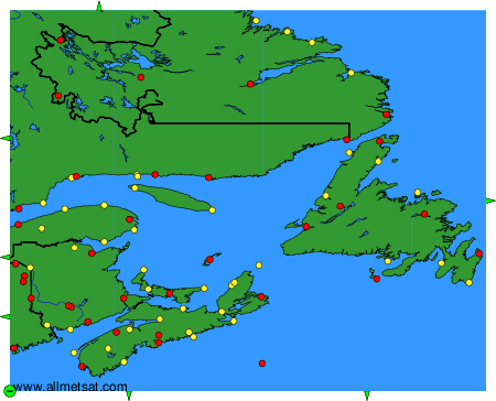
Osservazioni e previsioni meteorologiche di più di 4000 aeroporti (messaggi METAR e TAF).
Le stazioni disponibili sono rappresentate dai dischi gialli e rossi sulla carta.
Puntare il mouse per vedere il nome della stazione.
Clicca sopra per visualizzare le osservazioni e previsioni meteorologiche.
Per cambiare la mappa : fare clic sui pulsanti verdi con una croce nera per ingrandire, il pulsante verde con un trattino per diminuire, o sulla freccia verde per le mappe adiacenti.